19 Oct 06. The end of Summer.
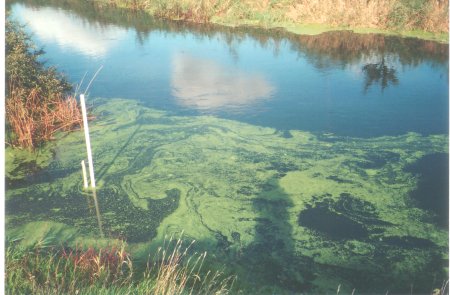
After 19 weeks of drought and low river, the first heavy rains of Autumn
start to swell the Stour. An area of thick duckweed near the level
measurer is stirred into swirling patterns before being swept away towards
the sea.
It was a significant, eerie and moving sight.
My shadow lies across the weed.

|
27 Nov 06. First Flood of the year.
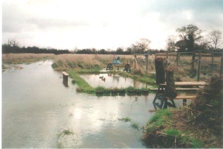
Twelve hours after the peak, the scrape still has competition from a
very large puddle, but the decoy ducks look happy. The whole plantation
is very soggy and every sapling stands in its own puddle.
The peak of the flood was near midnight,
impossible to photograph

|
27 Nov 06. Bridge over troubled water.
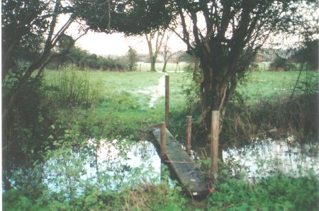
The North ditch is full, justifying the simple bridge I built.
To read the water level of the river Stour, nearly every day I cross this
bridge, and cross the field beyond (the path is usually dry). Then
between the two trees and 200 yards over another field to the river bank.
Here is sited the white graduated scale (see photo above left)
The results of three years recording can be seen on the
river graphs I keep.

|
25 Nov 06. Cumberland Gap.
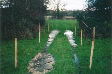
The muddiest part of the Reserve. We found a pile of old cheap crazy paving,
and with a load of gravel and 10 fenceposts, tried to solve the
problem. When the water table rose just before the November Flood, the
"Cumberland Gap" still flooded, but now it was easy to walk across with
wellies and a stick. With a few more flagstones and gravel, we could
even take our LandRover across. I guess the name we chose for this
damp fieldgate shows our age! (Plantation in distance).

|